

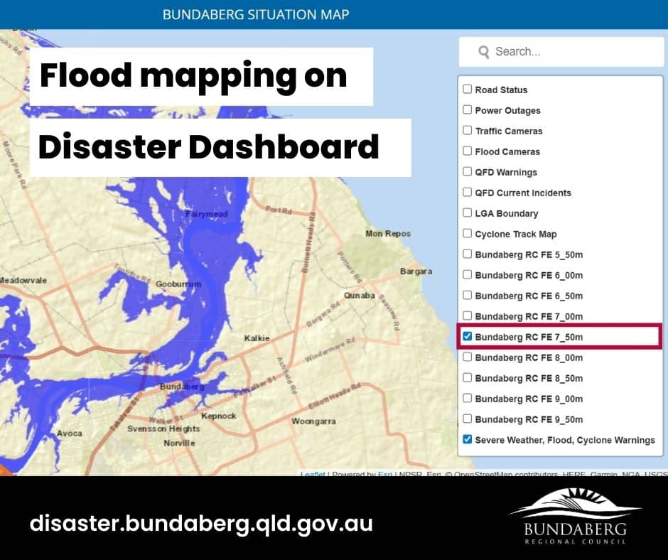
Residents can access flood gauge mapping to know their flood risk on the Bundaberg Regional Council Disaster Dashboard at disaster.bundaberg.qld.gov.au.
Council’s alternate flood mapping system is experiencing significant delays due to high traffic.
Residents can learn more about their flood risk by heading direct to disaster.bundaberg.qld.gov.au and accessing the map on the page.
On the right-hand side of the interactive map there is a series of mapping options to select.
By unselecting all options except for Bundaberg RC FE 7_50m residents can view the flood mapping for the current estimated flood levels.
Residents are urged to understand their flood risk and make an evacuation plan.


