

Bundaberg Regional Council has approved a significant residential development in Kalkie which will pave the way for future housing growth in the region.
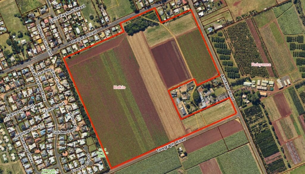
The development site is located at 6 Ashfield Road and will feature the subdivision of one existing lot into 256 residential lots.
The project will be delivered in nine stages and includes plans to manage stormwater through two detention basins as well as the creation of a public park for community use.
The site, which covers 29.5 hectares, is currently used for cropping and is surrounded by a mix of community, residential and agricultural uses.
It is zoned as Emerging Community under Council’s planning scheme, and has for many years been land identified to be developed for an urban purpose under the Kalkie-Ashfield local development area plan.
The development also includes a variation request which allows all future planning and building approvals to proceed as if the site were zoned for Low Density Residential use.
Lot sizes within the new estate will range from 558 square metres to 1,907 square metres.
The subdivision layout is designed to ensure good road connectivity, with pathways to Ashfield Road and Bargara Road and provides buffers between residential lots and surrounding agricultural uses and infrastructure.
Council approved the development subject to conditions to ensure it aligns with infrastructure, environmental and community planning objectives.
More news: Tenders open for purchase of AgTech Hub


When are the council going to do anything about upgrading the roads in Bundaberg, the traffic around town is horrendous especially Quay street , Walker Street , Bourbong Street and Takalvan Street, another bridge over the Burnett River would be a great idea also.
How long are we going to have to put up with this intrusion so many houses so much traffic the houses are mainly taken up by southerners. And you can tell .you try turning right on walker street now between 3 and 6 no body lets you ,they even sit at the intersection when lights are red up the road like they can’t see you .it’s like Hervey bay it’s been overpopulated and ruined
Looking at the map provided, it seems to me that this is rich red volcanic soil so why are we going to cover it with houses. Good agricultural land should be kept for agriculture and houses built only on the very poorest of soils.
It appears to me to be on an area of rich red volcanic soil. It troubles me that this first class agricultural land is being used for housing. I maintain that good agricultural land should be kept for agriculture and food production. We should be looking towards Food Security as much as for housing with a housing crisis. Surely we should be looking to build on some of the poorest of soils within our region.
Crazy!!!